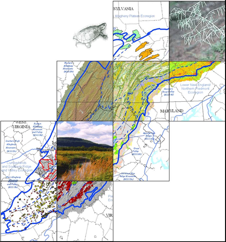
Maps |
Targets |
Spatial data |
Appendices
The Nature Conservancy’s Central Appalachian Forest ecoregion encompasses the Blue Ridge Mountains, the Great Valley, the Ridge and Valley, and the Allegheny Mountains of Virginia, West Virginia, Maryland, and Pennsylvania. Valleys are historically settled with farms and more recently with urban and suburban development, but the vast majority of the hills and mountains of this ecoregion are forested. Lying so close to the major East Coast metropolitan areas of Philadelphia, Baltimore, and Washington, D.C., the region represents a tremendous natural resource for both the local people and these urbanites. The high mountains, the lack of past glacial coverage, and the environmental diversity of this ecoregion have combined to make this area one of the most ecologically diverse regions of the eastern United States.
(pdf downloads)
Species:
 Methods
 used to assess plant and animal conservation targets: target selection, goal setting, and viability assessment (pdf).
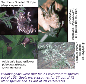
Animals and plants selected for the portfolio are in the
species results section (pdf).
The species target and goals tables from the original report's appendix are listed under the
appendices section of this page. Species EOs by subsection is an extract from
capoccurrences.xls that includes all species targets and their distribution across subsection.
Communities: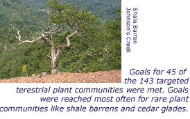 Communities methods
 used to assess community conservation targets include target selection, goal setting, and viability assessments.
Communities selected for the portfolio are in the plan reports
community results section (pdf).
The tables found in the appendix were assembled to support more detailed and flexible examination of target data, in particular for communities, as they are are distributed across subsections of the ecoregion. A reference map of the CAP subsections can be found at the top of this page.
CAP communities with goals (
table) compares the expert estimated numbers of associations and subsection distribution of ecosystems with the total number and number of viable examples per subsection included in Heritage databases. Note: the three woorksheets show various summary and detailed views.
Matrix Forests:
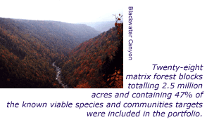 Methods
 used to develop and assess matrix-forming ecosystem conservation targets (pdf). Matrix forest examples selected for the portfolio are in the plan's
matrix-forming ecosystem results (pdf).
Aquatic Targets: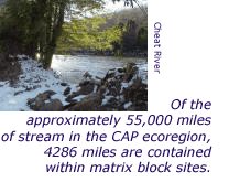
Preliminary remarks on freshwater aquatic targets are in the report's
aquatic results section (pdf).
Aquatic examples that were captured in the portfolio can be found in
capoccurrences.xls, which includes all species and communities Natural Heritage data for the CAP plan.
Download full data here
| Dataset name |
Definition |
|
Vector Data |
| block_ln |
Transportation features used to define ecoblock boundaries: minor roads, utility lines, railroads, and major hydrography line features. |
| block_py |
Ecoblocks, contiguous areas bounded by features such as minor and major roads, railroads, major utility lines, and major shorelines. |
| counties |
Line and polygon boundaries for counties in the northeastern U.S. |
| ecoregions |
Ecoregion boundaries for the eastern U.S. Source: TNC ECS, based on USFS (Keys et al.) subsections and Natural Heritage Program. |
| ecosubsect |
Ecoregion subsection boundaries. |
| mangarea |
All managed lands with a conservation purpose, along with other large state or federally managed lands greater than 500 acres. |
| matrix_init |
Initial 213 potential matrix forest examples. |
| matrix_tier12 |
Preferred and alternative matrix forest blocks. |
| placenames |
Place names: an automated inventory of major physical and cultural geographic features in the U.S. |
| portmatrix |
Preferred matrix forest blocks chosen for the portfolio. |
| states |
State boundaries in the eastern U.S. |
| trails |
Logging roads, fire roads, hiking trails, and other trails not useable by ordinary cars and trucks. |
|
Raster Data
|
| dem30_fill |
30 meter digital elevation model (DEM): national elevation dataset (NED) processed to fill cell depressions or "sinks" that reflect isolated surface error. |
| sys30cap |
Grid of 30 meter cells intended to capture the biophysical character of the ecoregion. Each cell value is a 6-digit number which codes the cell for landcover, elevation zone, geological substrate, and landform.
Metadata. |
Report Appendices
(.xls downloads)
List of conservation targets: species (
table)
List of conservation targets: communities (
table)
Species not included because of age or record of data quality (
table)
Analysis of met/unmet goals for species (
table)
Conservation status of federally listed species (
table)
Goals met/unmet for large and small patch terrestrial communities (
table)
CAP Communities with goals (
table)
EOs by subsection: Communities (
table)
EOs by subsection: Species (
table)
EOs by matrix: communities (
table)
