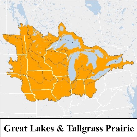
The Central region of the US and Canada stretches northward from the Hill Country of Northcentral Texas to the boreal forests of northwestern Ontario. Three major river systems coarse through this vast geography—the Mississippi, the Red River of the North, and the St. Lawrence, draining to the Gulf of Mexico, Hudson Bay and the Gulf of St. Lawrence, respectively. The region’s fertile soils—a legacy of glaciation—and historically mild climate, gave rise to its nickname, the “breadbasket,” given its status as one of the most productive agricultural regions of the world.
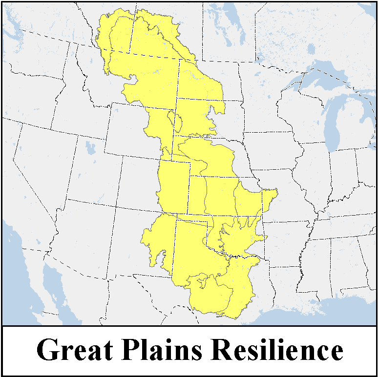
Widespread land conversion made space for grain-growing at a massive scale, resulting in dramatic loss of natural habitats. Yet many of the ecosystems that once prevailed in the Central region stile endure amidst broad swaths of largely altered landscapes. For example, the Great Plains harbor some of the finest remaining examples of intact prairie, as well as the Prairie Pothole Region, which provides habitat for more than half of North America’s migratory waterfowl. Shortgrass prairies of the west transition to mixed-grass and finally tallgrass prairies in the east, for example the Red River Valley of Minnesota and North Dakota. And in the Great Lakes region, large tracts of forest continue to protect roughly 20 percent of the world’s available freshwater, in turn moderating the climate of much of the upper Midwest. Some of the most severe seasonal temperature increases and changes in precipitation in North America are anticipated in this region, underscoring the importance of identifying resilient lands with enduring geophysical features that can support biodiversity into the future.
CLICK ON THE IMAGE TO VIEW THE RESILIENCE PROJECTS:
| 
|
Many places are vulnerable to the degrading effects of climate change. However, the characteristics of certain landscapes ensure that they will be more resilient than others to climate impacts. These climate-resilient sites are more likely to sustain native plants, animals, and natural processes into the future.
The Nature Conservancy undertook a major scientific research project to map the locations of climate-resilient sites. Teams of scientists mapped the bedrock and soils that underlie patterns of biodiversity as well as the topographic diversity and lack of fragmentation that promote natural resilience. The results were combined into an index that identifies the places more likely to sustain diversity because they offer a wide range of micro-climate options within a connected network.
In the Central US we have completed the Great Lakes and Tallgrass Prairie Region as well as the Great Plains. These areas are now combined into a National Resilient and Connected dataset. Click
here to go to the page of the rolled up
Resilient and Connected analyses for all regions.
Here is a direct link to the data page for the all region roll up.
