Mapping Conservation Opportunities for People and Nature
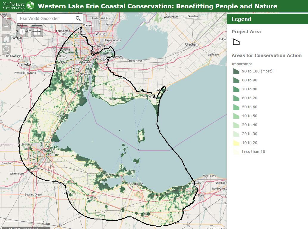
“Where are the best places to achieve regional conservation goals AND enhance human well-being?” That was the question that drove the analysis below, developed with and for communities, planners and conservation practitioners along 150 miles of western Lake Erie shoreline and spanning 25km (15.5 miles) inland, from Point Pelee, Ontario, to Loraine, Ohio.
For the first time in western Lake Erie, spatial datasets representing ecological targets, human well-being values and costs associated with implementing conservation practices - shared by local, state, federal, NGO and university partners - have been assessed together to illustrate where focused conservation investments can optimize benefits to people and nature.
Methods Summary
View the Map
Download GIS Data
Now, working with other regional landscape planning efforts like the Upper Midwest and Great Lakes Landscape Conservation Cooperative and the St. Clair-Detroit River System Initiative and the many partners that comprise these groups, we will continue to adaptively build upon this work and translate it to on-the-ground action that builds resilient coastal resources and communities.
Downloadable fact sheets of individual input data sets |
Explore the data sets we used to spatially represent ECOLOGICAL conservation targets and the socioeconomic COST of implementing conservation actions: |
| |
Explore the data sets used to spatially represent HUMAN WELL-BEING values: |
| |
Spatial data representing HUMAN WELL-BEING, or socioeconomic, VALUES. Human well-being values were derived from surveys during the LEBCS planning process and during stakeholder workshops held by The Nature Conservancy in Michigan, Ohio and Ontario in 2014. Human well-being values are represented by datasets for things like water quality protection, tourism and recreation and illustrate components of social, economic and ecological resilience.
Spatial data representing the COSTS associated with implementing conservation. Cost data was derived for four actual economic costs (e.g., Phragmites removal) and three indices that describe the relative difficulty of implementing conservation in an area given multiple socioeconomic interests (e.g., proximity to marinas, stream habitat improvements).
Lean more about The Nature Conservancy's on-the-ground conservation work in western Lake Erie:
Contact: Chris May | 517.316.2274
