The waters of the southeastern United States support a diverse array of habitats and species. Along the shoreline lie some of the most extensive salt marsh communities in the continental United States. As far as 100 miles from land lays the edge of the continental shelf, a steep slope that drops hundreds of feet in a short distance. Located in this unique ocean zone are hard bottom habitat – coral communities that form on rock ridges and hard surfaces. In the winter, the shallow waters off the coast of Georgia and northeast Florida serve as the lone calving grounds for the endangered North Atlantic Right Whale, a marine mammal that migrates along the entire Atlantic seaboard.
The South Atlantic Bight Marine Assessment (SABMA) is designed to increase understanding of the location, extent, and seasonality of these natural resources. The suite of species and habitats selected for inclusion are based upon opportunities to refine analysis completed as part of the
2005 Carolinian Ecoregional Assessment and incorporate methods used in the
Northwest Atlantic Marine Ecoregional Assessment to create consistent analysis datasets along the entire U.S. Atlantic Coast. 
Coastal Systems
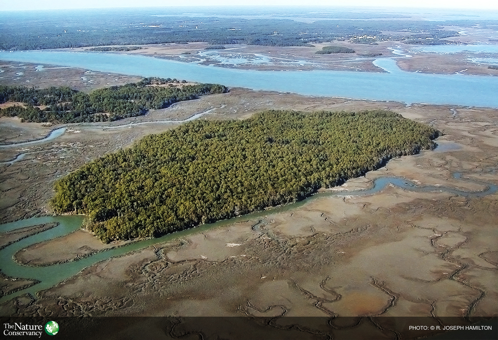
The coastal section incorporates both habitat and species information. Critical estuarine habitats include wetlands, mangroves, seagrass beds and oyster reefs. These habitats serve as nurseries, breeding grounds and forage areas for a variety of species while helping to maintain good water quality and protect upland areas. Integrating species population data into the coastal analysis enables understanding of connections between habitats, both within estuaries and with offshore habitats. For more on this subject follow these links:
Coastal Systems Chapter of the Assessment
Geodatabase
Data description
Seafloor Habitat
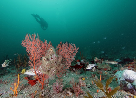
Depth, structure, geology and sediment are core components to defining habitats on the ocean bottom and their associated communities. By compiling and evaluating existing regional data sources, the Assessment depicts the diversity of seafloor habitats that exist off the coast of North Carolina, South Carolina, Georgia and Florida. For more on this subject follow these links:
Seafloor Habitat Chapter of the Assessment
Seafloor Story Map (browser other than Internet Explorer)
Geodatabase
Migratory Species
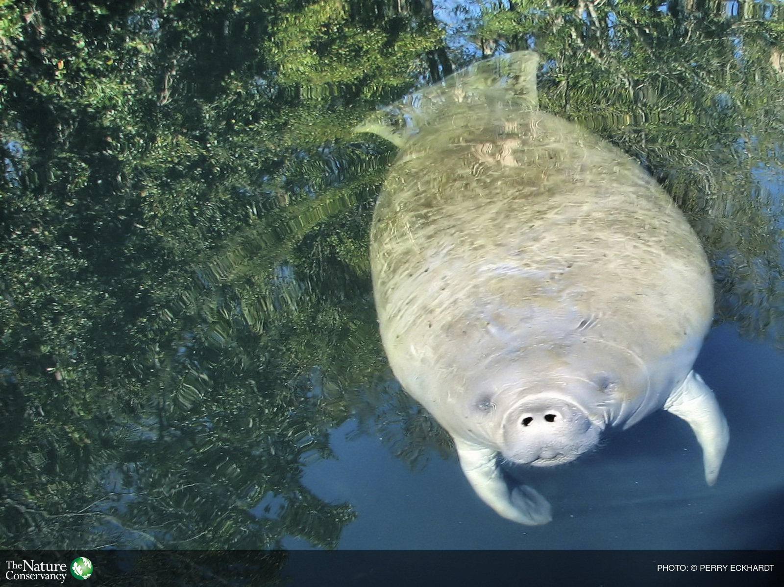
Populations that utilize multiple habitats and regions throughout their lifecycle provide a unique opportunity to look across different habitats. Though a variety of species groups were discussed, including seabirds and pelagic fish, emphasis in the assessment is on marine mammals and sea turtles. For more on this subject follow these links:
Migratory Species Chapter of the Assessment
Geodatabase
