The medium river macrogroup consists of the following aquatic habitat types:
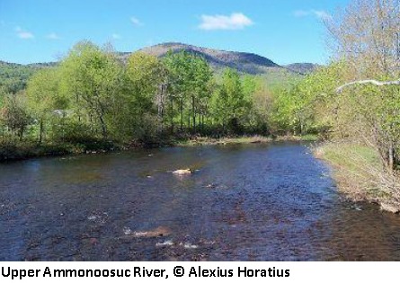
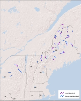
Cold, Medium River
Distribution:
ME, NH, NY, VT. 693 miles of habitat in the region, of which 36.1% of the 100m riparian buffer is conserved.
Description:
Cold, medium-sized rivers of the northern region. These medium sized rivers drain watersheds up to 1000 sq.mi. in size and have an average bankfull width of 131 feet. Slower moving, lower gradient sections of these rivers are expected to be more unconfined with higher sinuosity, broader floodplain valleys, more riparian wetlands, and lower width/depth ratios than the more moderate gradient portions. Permanent cold water temperatures in these rivers means coldwater fish species likely represent over half of the fish community. Examples of this river type in the region include the Allagash, Aroostook, Southwest Branch Saint John, East Branch Penobscot, West Branch Penobscot, Moose, Piscataquis, Upper Connecticut, Raquette, and Upper Hudson.
Download the
pdf for this habitat for information about species, crosswalks to state names, and condition of this habitat.
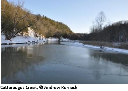
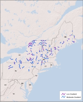
Cool, Medium River
Distribution:
CT, ME, MA, NH, NY, PA, VT. 2,661 miles of habitat in the region, of which 13.7% of the 100m riparian buffer is conserved.
Description:
Cool, medium-sized rivers of the moderate elevation northern region. These medium sized rivers drain watersheds up to 1000 sq.mi. in size and have an average bankfull width of 115 feet. Slower moving, lower gradient sections of these rivers are expected to be more unconfined with higher sinuosity, broader floodplain valleys, more riparian wetlands, and lower width/depth ratios than the more moderate gradient portions. Cool water temperatures in these rivers means the fish community will support few permanent coldwater species and will contain a higher proportion of cool and warm water species relative to coldwater species. Examples of this type in the region include the Missisquoi, Lamoile, Saranac, Saint Regis, Uper Saco, Grass, Oswegatchie, Otter Creek, Hoosic, Schoharie Creek, Chenango, Housatonic, Genesee, Pine Creek, and Clarion River.
Download the
pdf for this habitat for information about species, crosswalks to state names, and condition of this habitat.
Warm, Medium River
Distribution:
CT, DE, ME, MD, MA, NH, NJ, NY, PA, RI, VA, WV. 4,953 miles of habitat in the region, of which 8.8% of the 100m riparian buffer is conserved.
Description:
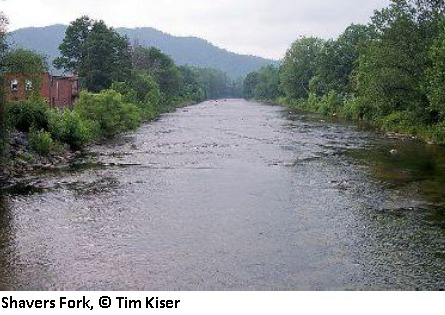
Warm, medium-sized rivers of the low elevation north and of the Mid-Atlantic. These medium sized rivers drain watersheds up to 1000 sq.mi. in size and have an average bankfull width of 115 feet. Slower moving, lower gradient sections of these rivers are expected to be more unconfined with higher sinuosity, broader floodplain valleys, more riparian wetlands, and lower width/depth ratios than the more moderate gradient portions. Warm water temperatures in these rivers means the fish community will contain a higher proportion of warmwater species relative to coolwater species. These systems are unlikely to support any resident coldwater species. Examples of this type in the region include French Creek, Conodoguinet Creek, North Branch Potomac, Cacapon, North Fork Shenandoah, Lieelt Kanawah, Elk, Mattaponi, Greenbrier, Appomattox, Guyandote, Tug Fork, Meherrin, Clinch, and North Fork Holston.
Download the
pdf for this habitat for information about species, crosswalks to state names, and condition of this habitat.