Nevada iGDE Summary Hydrographic Areas map (JPG, PDF)
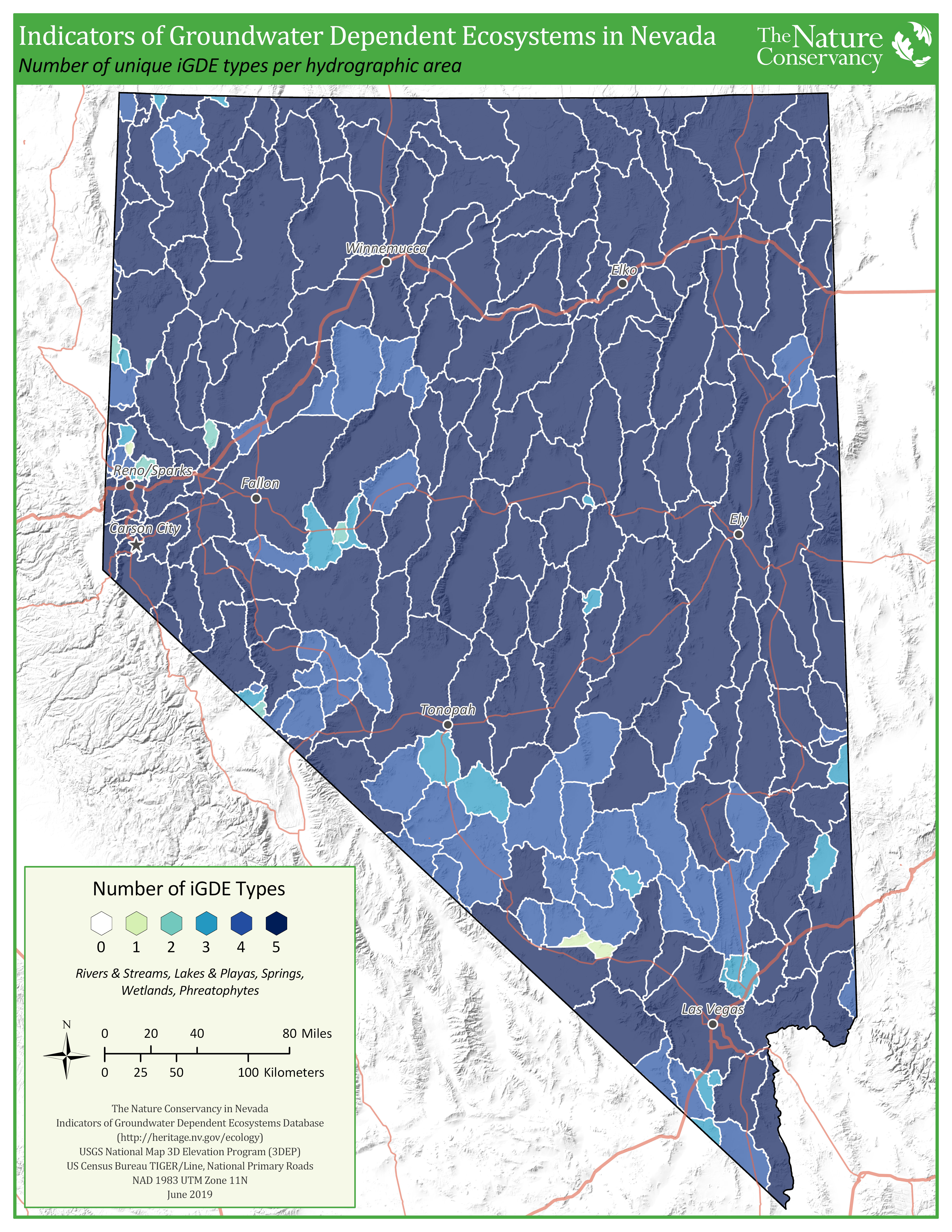
This map shows the number of unique GDE categories (phreatophtye communities; wetlands; springs; lakes and playas; rivers and streams) in each of the 256 hydrographic areas (administrative units for groundwater management) in Nevada.
Preview

Subject Tags
- Groundwater
Description
This map summarizes data from the Nevada Indicators of Groundwater Dependent Ecosystems (iGDE) database that was completed in 2019. In Nevada, groundwater is administered in 256 hydrographic areas, so this map shows how many of the unique GDE categories (i.e., phreatophyte communities, wetlands, springs, lakes and playas, or rivers and streams) are in each hydrographic area, with darker hydrographic areas indicating more GDE types. See the Nevada iGDE story map for more information.
Click on view resource to get a .pdf and below to get a .jpg version of the map.