The Northwest Atlantic Marine Ecoregional Assessment (NAM ERA) synthesized comprehensive data on species distributions, geology, oceanography, chemistry, biology and social science to create maps and other tools that reveal conservation priorities and inform management decisions to help sustain coastal and marine ecosystems and the people that depend on them.
Introduction to this assessment
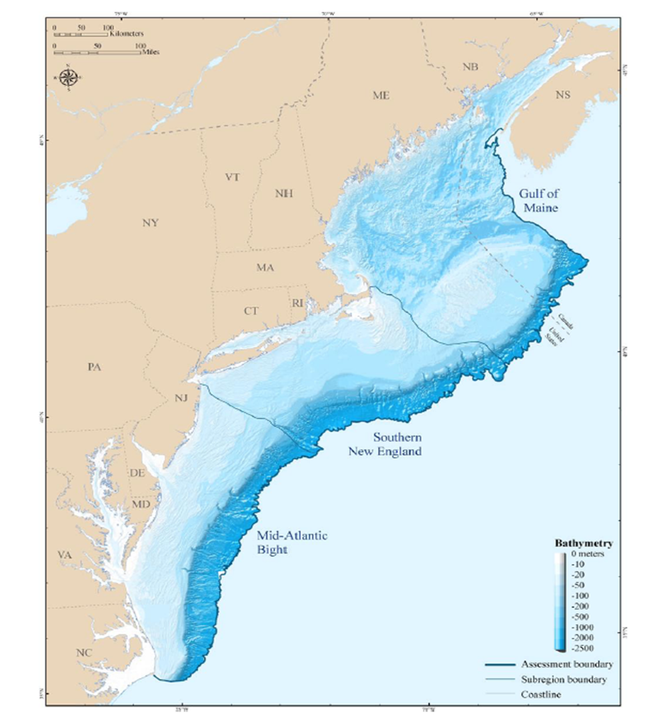
The Northwest Atlantic region is known for its cold, nutrient-rich, and highly productive waters that have sustained regional economies for centuries. With its strong tidal flows, complex circulation patterns, and varied seafloor topography the region supports large diverse populations of bottom dwelling fish and an array of benthic communities.
The Northwest Atlantic region spans the area from Cape Hatteras in North Carolina to the northern limit of the Gulf of Maine in Canadian waters, and extends from the mean high tide mark seaward to the foot of the continental slope (depth of 2,500m). The study area includes the shorelines of 11 states and two Canadian provinces inhabited by more than 65 million people.
The Nature Conservancy's goals in conducting the Northwest Atlantic Marine Ecoregional Assessment were to produce a baseline of scientific information on the distribution and status of key habitats and species, and a map and report of priority conservation areas for the region's marine biodiversity.
